Click here to go to the Rocky Mountain National Park website.
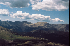
Rocky Mountain National Park is an American national park located approximately 76 mi (122 km) northwest of Denver International Airport in north-central Colorado, within the Front Range of the Rocky Mountains. The park is situated between the towns of Estes Park to the east and Grand Lake to the west. The eastern and western slopes of the Continental Divide run directly through the center of the park with the headwaters of the Colorado River located in the park’s northwestern region. The main features of the park include mountains, alpine lakes and a wide variety of wildlife within various climates and environments, from wooded forests to mountain tundra.
The Rocky Mountain National Park Act was signed by President Woodrow Wilson on January 26, 1915, establishing the park boundaries and protecting the area for future generations. The Civilian Conservation Corps built the main automobile route, Trail Ridge Road, in the 1930s. In 1976, UNESCO designated the park as one of the first World Biosphere Reserves. In 2018, more than 4.5 million recreational visitors entered the park. The park is one of the most visited in the National Park System, ranking as the third most visited national park in 2015.
History
The history of Rocky Mountain National Park began when Paleo-Indians traveled along what is now Trail Ridge Road to hunt and forage for food. Ute and Arapaho people subsequently hunted and camped in the area. In 1820, the Long Expedition, led by Stephen H. Long for whom Longs Peak was named, approached the Rockies via the Platte River. European settlers began arriving in the mid-1800s, displacing the Native Americans who mostly left the area voluntarily by 1860, while others were removed to reservations by 1878.
Lulu City, Dutchtown, and Gaskill in the Never Summer Mountains were established in the 1870s when prospectors came in search of gold and silver. The boom ended by 1883 with miners deserting their claims. The railroad reached Lyons, Colorado in 1881 and the Big Thompson Canyon Road—a section of U.S. Route 34 from Loveland to Estes Park—was completed in 1904. The 1920s saw a boom in building lodges and roads in the park, culminating with the construction of Trail Ridge Road to Fall River Pass between 1929 and 1932, then to Grand Lake by 1938.
Geography
Rocky Mountain National Park encompasses 265,461 acres (414.78 sq mi; 1,074.28 km2) of federal land, with an additional 253,059 acres (395.40 sq mi; 1,024.09 km2) of U.S. Forest Service wilderness adjoining the park boundaries. The Continental Divide runs generally north–south through the center of the park, with rivers and streams on the western side of the divide flowing toward the Pacific Ocean while those on the eastern side flow toward the Atlantic.
A geographical anomaly is found along the slopes of the Never Summer Mountains where the Continental Divide forms a horseshoe–shaped bend for about 6 miles (9.7 km), heading from south–to–north but then curving sharply southward and westward out of the park. The sharp bend results in streams on the eastern slopes of the range joining the headwaters of the Colorado River that flow south and west, eventually reaching the Pacific. Meanwhile, streams on the western slopes join rivers that flow north and then east and south, eventually reaching the Atlantic.
The headwaters of the Colorado River are located in the park’s northwestern region. The park contains approximately 450 miles (724 km) of rivers and streams, 350 miles (563 km) of trails, and 150 lakes.
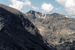
Rocky Mountain National Park is one of the highest national parks in the nation, with elevations from 7,860 to 14,259 feet (2,396 to 4,346 m), the highest point of which is Longs Peak. Trail Ridge Road is the highest paved through-road in the country, with a peak elevation of 12,183 feet (3,713 m). Sixty mountain peaks over 12,000 feet (3,658 m) high provide scenic vistas. On the north side of the park, the Mummy Range contains a number of thirteener peaks, including Hagues Peak, Mummy Mountain, Fairchild Mountain, Ypsilon Mountain, and Mount Chiquita. Several small glaciers and permanent snowfields are found in the high mountain cirques.
There are five regions, or geographical zones, within the park.
Elevation
Higher elevation areas within the park receive twice as much precipitation as lower elevation areas, generally in the form of deep winter snowfall. Arctic conditions are prevalent during the winter, with sudden blizzards, high winds, and deep snowpack. High country overnight trips require gear suitable for -35 °F or below.
Wild roses (Rosa acicularis) bloom from montane to subalpine regions
The subalpine region does not begin to experience spring-like conditions until June. Wildflowers bloom from late June to early August.
Below 9,400 feet (2,865 m), temperatures are often moderate, although nighttime temperatures are cool, as is typical of mountain weather.[51] Spring comes to the montane area by early May, when wildflowers begin to bloom. Spring weather is subject to unpredictable changes in temperature and precipitation, with potential for snow along trails through May. In July and August, temperatures are generally in the 70s or 80s °F during the day, and as low as the 40s °F at night. Lower elevations receive rain as most of their summer precipitation.
Sudden dramatic changes in the weather may occur during the summer, typically due to afternoon thunderstorms that can cause as much as a 20 °F drop in temperature and windy conditions.
Continental Divide
The park’s climate is also affected by the Continental Divide, which runs northwest to southeast through the center of the park atop the high peaks. The Continental Divide creates two distinct climate patterns – one typical of the east side near Estes Park and the other associated with the Grand Lake area on the park’s west side. The west side of the park experiences more snow, less wind, and clear cold days during the winter months.
Geology
Main articles: Geology of the Rocky Mountains and Prehistory of Colorado
Precambrian metamorphic rock formed the core of the North American continent during the Precambrian eon 4.5–1 billion years ago. During the Paleozoic era, western North America was submerged beneath a shallow sea, with a seabed composed of limestone and dolomite deposits many kilometers thick. Pikes Peak granite formed during the late Precambrian eon, continuing well into the Paleozoic era, when mass quantities of molten rock flowed, amalgamated, and formed the continents about 1 billion–300 million years ago. Concurrently, in the period from 500–300 million years ago, the region began to sink while lime and mud sediments were deposited in the vacated space. Eroded granite produced sand particles that formed strata—layers of sediment—in the sinking basin.
About 300 million years ago, the land was uplifted creating the ancestral Rocky Mountains. Fountain Formation was deposited during the Pennsylvanian period of the Paleozoic era, 290–296 million years ago. Over the next 150 million years, the mountains uplifted, continued to erode, and covered themselves in their own sediment. Wind, gravity, rainwater, snow, and glacial ice eroded the granite mountains over geologic time scales. The Ancestral Rockies were eventually buried under subsequent strata.
Cretaceous seaway
The Pierre Shale formation was deposited during the Paleogene and Cretaceous periods about 70 million years ago. The region was covered by a deep sea—the Cretaceous Western Interior Seaway—which deposited massive amounts of shale on the seabed. Both the thick stratum of shale and embedded marine life fossils—including ammonites and skeletons of fish and such marine reptiles as mosasaurs, plesiosaurs, and extinct species of sea turtles, along with rare dinosaur and bird remains—were created during this time period. The area now known as Colorado was eventually transformed from being at the bottom of an ocean to dry land again, giving yield to another fossiliferous rock layer known as the Denver Formation.
At about 68 million years ago, the Front Range began to rise again due to the Laramide orogeny in the west. During the Cenozoic era, block uplift formed the present Rocky Mountains. The geologic composition of Rocky Mountain National Park was also affected by deformation and erosion during that era. The uplift disrupted the older drainage patterns and created the present drainage patterns.
Glaciation
Andrews Glacier
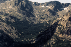
Glacial geology in Rocky Mountain National Park can be seen from the mountain peaks to the valley floors. Ice is a powerful sculptor of this natural environment and large masses of moving ice are the most powerful tools. Telltale marks of giant glaciers can be seen all throughout the park. Streams and glaciations during the Quaternary period cut through the older sediment, creating mesa tops and alluvial plains, and revealing the present Rocky Mountains. The glaciation removed as much as 5,000 feet (1,500 m) of sedimentary rocks from earlier inland sea deposits. This erosion exposed the basement rock of the Ancestral Rockies. Evidence of the uplifting and erosion can be found on the way to Rocky Mountain National Park in the hogbacks of the Front Range foothills. Many sedimentary rocks from the Paleozoic and Mesozoic eras exist in the basins surrounding the park.
While the glaciation periods are largely in the past, the park still has several small glaciers. The glaciers include Andrews, Sprague, Tyndall, Taylor, Rowe, Mills, and Moomaw Glaciers.
Geology
Main articles: Geology of the Rocky Mountains and Prehistory of Colorado
Precambrian metamorphic rock formed the core of the North American continent during the Precambrian eon 4.5–1 billion years ago. During the Paleozoic era, western North America was submerged beneath a shallow sea, with a seabed composed of limestone and dolomite deposits many kilometers thick.[57] Pikes Peak granite formed during the late Precambrian eon, continuing well into the Paleozoic era, when mass quantities of molten rock flowed, amalgamated, and formed the continents about 1 billion–300 million years ago. Concurrently, in the period from 500–300 million years ago, the region began to sink while lime and mud sediments were deposited in the vacated space. Eroded granite produced sand particles that formed strata—layers of sediment—in the sinking basin.[58]:1
About 300 million years ago, the land was uplifted creating the ancestral Rocky Mountains.[58]:1 Fountain Formation was deposited during the Pennsylvanian period of the Paleozoic era, 290–296 million years ago. Over the next 150 million years, the mountains uplifted, continued to erode, and covered themselves in their own sediment. Wind, gravity, rainwater, snow, and glacial ice eroded the granite mountains over geologic time scales.[58]:6 The Ancestral Rockies were eventually buried under subsequent strata.[58]:10
Cretaceous seaway
The Pierre Shale formation was deposited during the Paleogene and Cretaceous periods about 70 million years ago. The region was covered by a deep sea—the Cretaceous Western Interior Seaway—which deposited massive amounts of shale on the seabed. Both the thick stratum of shale and embedded marine life fossils—including ammonites and skeletons of fish and such marine reptiles as mosasaurs, plesiosaurs, and extinct species of sea turtles, along with rare dinosaur and bird remains—were created during this time period. The area now known as Colorado was eventually transformed from being at the bottom of an ocean to dry land again, giving yield to another fossiliferous rock layer known as the Denver Formation.[58]:16
At about 68 million years ago, the Front Range began to rise again due to the Laramide orogeny in the west.[58]:16,[59]:8 During the Cenozoic era, block uplift formed the present Rocky Mountains. The geologic composition of Rocky Mountain National Park was also affected by deformation and erosion during that era. The uplift disrupted the older drainage patterns and created the present drainage patterns.
Alpine tundra
Above tree line, at approximately 11,000 ft (3,400 m), trees disappear and the vast alpine tundra takes over. Over one third of the park resides above the tree line, an area which limits plant growth due to the cold climate and strong winds. The few plants that can survive under such extreme conditions are mostly perennials. Many alpine plants are dwarfed at high elevations, though their occasional blossoms may be full-sized.
View on Tundra Communities Trail
Cushion plants have long taproots that extend deep into the rocky soil. Their diminutive size, like clumps of moss, limits the effect of harsh winds. Many flowering plants of the tundra have dense hairs on stems and leaves to provide wind protection or red-colored pigments capable of converting the sun’s light rays into heat. Some plants take two or more years to form flower buds, which survive the winter below the surface and then open and produce fruit with seeds in the few weeks of summer. Grasses and sedges are common where tundra soil is well-developed.
Non-flowering lichens cling to rocks and soil. Their enclosed algal cells can photosynthesize at any temperature above 32 degrees Fahrenheit (0 °C), and the outer fungal layers can absorb more than their own weight in water. Adaptations for survival amidst drying winds and cold temperatures may make tundra vegetation seem very hardy, but in some respects it remains very fragile. Footsteps can destroy tundra plants and it may take hundreds of years to recover. Mammals that live on the alpine tundra, or visit during the summer season, include bighorn sheep, elk, badgers, pikas, yellow-bellied marmots, and snowshoe hares. Birds include prairie falcons, white-tailed ptarmigans, and common ravens. Flowering plants include mertensia, sky pilot, alpine sunflowers, alpine dwarf columbine, and alpine forget-me-not. Grasses include kobresia, spike trisetum, spreading wheatgrass, and tufted hairgrass.
Wildlife
Rocky Mountain National Park is home to many species of animals, including nearly 70 mammals and almost 300 species of birds. This diversity is due to the park’s varying topography, which creates a variety of habitats. However, some species have been extirpated from the park, including the gray wolf, the wolverine, the grizzly bear, and the American bison.

